TIDMALBA
RNS Number : 2244I
Alba Mineral Resources PLC
10 August 2021
Click on or paste the following link into your website browser
to view the associated PDF document (including maps and images):
http://www.rns-pdf.londonstockexchange.com/rns/2244I_1-2021-8-10.pdf
Alba Mineral Resources plc
("Alba" or the "Company")
Amitsoq Graphite Update
Maiden Drilling Campaign Intersects Significant Graphite
Layers
Alba Mineral Resources plc (AIM: ALBA) is pleased to report on
the successful completion of drilling operations at the Amitsoq
Graphite Project in southern Greenland.
Key Points
-- Drilling operations at the Amitsoq Island deposit have been completed.
-- Drilling has confirmed the existence of two significant and
laterally continuous graphite horizons, confirming Alba's existing
geological model.
-- All completed drillholes intersected either the Upper
Graphite Layer ("UGL") or Lower Graphite Layer ("LGL") or both.
-- Several graphite intersections are considerably thicker than
expected from the modelling, up to 8.19m in the UGL and up to
15.54m in the LGL.
-- Ground geophysics and sampling of the Kalaaq mainland
discovery and environmental baseline studies have also been
completed.
-- Trenching of target areas at Kalaaq have revealed graphite beds up to 10m thick.
Mark Austin, Alba's Chief Operating Officer, commented:
"We are delighted to have encountered such thick graphite
intersections at Amitsoq, well in excess of what we had projected
from our structural modelling. We were also pleasantly surprised by
the condition of the old mine workings and this will be an
important factor as we move towards the long-term development of
this very high-grade graphite project."
"We will be sending the drill core to an accredited laboratory
for assaying as soon as possible. The assay results will then be
handed over to the independent competent person to assist in his
resource estimation work."
Details
Alba subsidiary Obsidian Mining Limited ("Obsidian") has
completed its planned diamond-drilling programme at the Amitsoq
Island deposit, part of the Amitsoq Graphite Project, with the aim
of establishing a maiden Mineral Resource there.
A follow-up mapping and ground geophysical survey of the Kalaaq
graphite deposit has also been completed on the mainland section of
the Amitsoq licence area.
Obsidian's field exploration team of geologists and assistants,
drill crew and environmental contractors were accommodated on a
chartered vessel anchored close to the drill site for the duration
of the programme. Helicopter support was provided in order to
transport equipment to site and to move the drill rig between pad
locations.
Of the five drill pads that had been prepared, only Pads A, B,
C, and E were utilised. The most northerly location, Pad D, was not
reached due to technical issues. All eight completed holes
intersected graphite mineralisation, two from Pad A, three from Pad
B and three from Pad E. A total of 935m were drilled. This was down
on the planned 15 holes for up to 1,700 metres, principally due to
ground conditions at Pads C and D. Although drilling was commenced
from Pad C, it did not manage to attain the required depths to
intersect the expected graphite horizons due to ground conditions.
This will be revisited in the next drilling programme, using
different techniques to counteract the ground conditions.
The core was drilled initially using an HQ3 drill string but
switched to NQ for the last two holes. Figure 3 (in the PDF version
of this RNS) shows a photograph of the southern part of Amitsoq
Island facing north-west and showing the position of the drillholes
on the topography.
Table 1 summarises the results of the drilling programme to
date.
Table 1: Summary of graphite intersections
[NB: UTM 23N. True Width assuming a graphite dip of 30deg]
    Hole       Pad     Azimuth    Inclination    Upper Graphite     True     Lower Graphite     True     eoh     Core
    Number              (deg)         (deg)         Depth (m)       Width       Depth (m)       Width    (m)     Size
                                                                     (m)                         (m)
------------  -----  ----------  -------------                    -------                     -------  ------  -------
                                                  From      To               From       To
------------  -----  ----------  -------------  -------           -------  --------           -------  ------  -------
 AM-DD-013A     A     VERTICAL       -90deg      20.90    30.36     8.19       -        -        -      110.7    HQ3
 AM-DD-014      A      141deg        -60deg      18.71    25.80     7.09       -        -        -      26.0     HQ3
 AM-DD-004      B     VERTICAL       -90deg      47.67    51.89     3.65       -        -        -      105.0    HQ3
 AM-DD-005      B      141deg        -60deg      45.75    48.71     2.96     93.64    109.18   15.54    112.8   HQ3/NQ
 AM-DD-006      B      141deg        -85deg      45.29    49.69     3.81    102.21    118.66   14.25    122.0     NQ
 AM-DD-008      E      141deg        -70deg        -        -        -       95.60    99.50     3.38    107.5    HQ3
 AM-DD-009      E      141deg        -45deg        -        -        -       95.48    96.00     0.45    104.2    HQ3
 AM-DD-015      E     VERTICAL       -90deg        -        -        -      113.00    121.35    7.23    128.4    HQ3
              -----              -------------  -------           -------  --------           -------  ------  -------
The geological model used for the Exploration Target
calculation, as shown in Figure 4 (in the PDF version of this RNS),
has been confirmed by the drilling results. Five intersections of
the Upper Graphite Layer have been recorded, measuring 8.19m,
7.09m, 3.65m, 2.96, and 3.81m (true widths), as well as five
intersections of the Lower Graphite Layer, measuring 15.54m,
14.25m, 3.38, 0.45m and 7.23m (true widths).
Figure 4 (in the PDF version of this RNS) shows the details of
the holes drilled from Pad B. It is noteworthy that the
intersections are generally greater in width than predicted by the
geological model.
In addition to the drilling, Obsidian's geological team have
chip sampled the graphite outcrops in line with the drill fences in
order to supplement the graphite mineralisation information to be
used in the forthcoming resource estimation work.
The graphite mine, which was abandoned in the 1930s, has been
accessed and mapped by the geological team. Figure 7 (in the PDF
version of this RNS) shows the condition of the workings and the
scale of the graphite (the Lower Graphite Layer is shown in this
photo) which is in agreement with some of the borehole intersection
widths.
The workings will be channel sampled in the next exploration
campaign and will, undoubtably, contribute important information
for the resource and future mining layouts.
Other Field Work
Kalaaq Exploration Programme
A follow-up mapping and ground geophysical survey of the Kalaaq
graphite deposit has been completed on the mainland section of the
Amitsoq licence area. The programme was led by senior Greenlandic
geologist Ole Christiansen, and involved extensive mapping and
sampling, as well as a "beep mat" survey to record electromagnetic
(EM) conductivity and magnetic susceptibility down to 3 metres
below surface, through the overburden. This technique was used to
great effect in 2017 to identify and map the graphite occurrences
at Kalaaq.
During the programme, the team excavated two trenches, revealing
graphite zones. The Kalaaq area contains multiple horizons of
graphite mineralisation that are interpreted to have been subject
to complex folding. Average grades from sampling conducted at
Kalaaq are 25.6% TGC , also among the highest of any project in the
world.
The results of this exploration programme will be used to refine
drill targets at Kalaaq.
Environmental Baseline Studies
Experienced environmental consultants BioApp Greenland have
completed the first-year environmental baseline screening programme
at Amitsoq during this summer's field programme . The results of
this work will form part of a future environmental impact
assessment for the project, which will be a requirement for a
future mining licence application.
This announcement contains inside information for the purposes
of the UK Market Abuse Regulation and the Directors of the Company
are responsible for the release of this announcement.
Forward Looking Statements
This announcement contains forward-looking statements relating
to expected or anticipated future events and anticipated results
that are forward-looking in nature and, as a result, are subject to
certain risks and uncertainties, such as general economic, market
and business conditions, competition for qualified staff, the
regulatory process and actions, technical issues, new legislation,
uncertainties resulting from potential delays or changes in plans,
uncertainties resulting from working in a new political
jurisdiction, uncertainties regarding the results of exploration,
uncertainties regarding the timing and granting of prospecting
rights, uncertainties regarding the timing and granting of
regulatory and other third party consents and approvals,
uncertainties regarding the Company's or any third party's ability
to execute and implement future plans, and the occurrence of
unexpected events.
Without prejudice to the generality of the foregoing,
uncertainties also exist in connection with the ongoing Coronavirus
(COVID-19) pandemic which may result in further lockdown measures
and restrictions being imposed by Governments and other competent
regulatory bodies and agencies from time to time in response to the
pandemic, which measures and restrictions may prevent or inhibit
the Company from executing its work activities according to the
timelines set out in this announcement or indeed from executing its
work activities at all. The Coronavirus (COVID-19) pandemic may
also affect the Company's ability to execute its work activities
due to personnel and contractors testing positive for COVID-19 or
otherwise being required to self-isolate from time to time.
Actual results achieved may vary from the information provided
herein as a result of numerous known and unknown risks and
uncertainties and other factors.
Competent Person Declaration
The information in this release that relates to Exploration
Results has been reviewed by Mr Mark Austin. Mr Austin is a member
of SACNASP (Reg. No. 400235/06), Fellow of The Geological Society
and Fellow of the Geological Society of South Africa. He has a
B.Sc. Honours in Geology with 38 years' experience.
Mark Austin has sufficient experience that is relevant to the
style of mineralisation and type of deposit under consideration and
to the activity being undertaken to qualify as a Competent Person
as defined in the 2012 Edition of the 'Australasian Code for
Reporting of Exploration targets, Exploration Results, Mineral
Resources and Ore Reserves', also known as the JORC Code. The JORC
code is a national reporting organisation that is aligned with
CRIRSCO. Mr Austin consents to the inclusion in the announcement of
the matters based on his information in the form and context in
which they appear.
Glossary
Electromagnetic (or EM) survey : a geophysical survey method
which measures the electromagnetic properties of rocks.
Graphitic : of, relating to, resembling, or having the structure
of graphite.
Graphitic Carbon or Total Graphitic Carbon (TGC) : Carbon may be
present in rocks in various forms including organic carbon,
carbonates or graphitic carbon. Carbon in rocks may be reported as
fixed or total carbon (i.e. organic carbon + carbon in carbonate
minerals + carbon as graphite) or as graphitic carbon or total
graphitic carbon (or TGC) (i.e. total carbon - (organic + carbonate
carbon)).
Overburden : material that lies above an area (the orebody) that
lends itself to economical exploitation.
For further information, please contact:
 Alba Mineral Resources plc
  George Frangeskides, Executive Chairman    +44 20 3950 0725

 Cairn Financial Advisers LLP (Nomad)
  James Caithie / Liam Murray                +44 20 7213 0880

 ETX Capital (Broker)
  Thomas Smith                               +44 20 7392 1494
Alba's Project and Investment Portfolio
 Project (commodity)            Location     Ownership
 Mining Projects
 Amitsoq (graphite)             Greenland    100%
                               -----------  ----------
 Clogau (gold)                  Wales        90%
                               -----------  ----------
 Gwynfynydd (gold)              Wales        100%
                               -----------  ----------
 Inglefield (copper, cobalt,
  gold)                         Greenland    100%
                               -----------  ----------
 Limerick (zinc-lead)           Ireland      100%
                               -----------  ----------
 Melville Bay (iron ore)        Greenland    100%
                               -----------  ----------
 TBS (ilmenite)                 Greenland    100%
                               -----------  ----------
 Oil & Gas Investments
 Horse Hill (oil)               England      11.765%
                               -----------  ----------
This information is provided by RNS, the news service of the
London Stock Exchange. RNS is approved by the Financial Conduct
Authority to act as a Primary Information Provider in the United
Kingdom. Terms and conditions relating to the use and distribution
of this information may apply. For further information, please
contact rns@lseg.com or visit www.rns.com.
RNS may use your IP address to confirm compliance with the terms
and conditions, to analyse how you engage with the information
contained in this communication, and to share such analysis on an
anonymised basis with others as part of our commercial services.
For further information about how RNS and the London Stock Exchange
use the personal data you provide us, please see our Privacy
Policy.
END
DRLDGGDIRBBDGBG
(END) Dow Jones Newswires
August 11, 2021 02:00 ET (06:00 GMT)
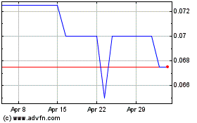
Alba Mineral Resources (LSE:ALBA)
Historical Stock Chart
From Mar 2024 to Apr 2024

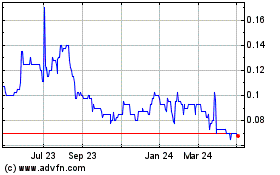
Alba Mineral Resources (LSE:ALBA)
Historical Stock Chart
From Apr 2023 to Apr 2024
