Intermap Announces Subscription with Outdoor Recreation Platform
26 June 2023 - 9:30PM

Intermap Technologies (TSX: IMP; OTCQB: ITMSF) (“Intermap” or the
“Company”), a global leader in 3D geospatial products and
intelligence solutions, today announced a two-year data
subscription agreement with a leading outdoor recreation and
fitness platform.
Intermap’s NEXTMap® elevation data is seamlessly integrated into
the platform, providing users with access to precise terrain
information for planning routes, collecting performance metrics and
exploring trails and points of interest. The Company’s datasets
provide a comprehensive solution for global elevation data,
ensuring continuous, consistent data quality worldwide.
The platform has tens of millions of active users who will
benefit from NEXTMap’s detailed terrain data. Whether it’s for
exploring new trails with 3D visualization, tracking performance
metrics with accurate distance and gradient statistics or sharing
adventures with friends, Intermap's data enriches the user
experience and provides the confidence for safe planning,
navigation and enjoyment of outdoor activities.
“We are excited to provide the outdoor community with access to
our elevation data through this platform,” said Patrick A. Blott,
Intermap Chairman and CEO. “By combining our high-resolution,
globally available elevation data with the platform’s innovative
offerings, we empower users around the world with key information
and insights for engaging in a diverse range of outdoor
activities.”
To learn more about Intermap’s elevation data, visit
intermap.com/nextmap.
Intermap Reader AdvisoryCertain
information provided in this news release, including reference to
revenue growth, constitutes forward-looking statements. The words
"anticipate", "expect", "project", "estimate", "forecast", “will
be”, “will consider”, “intends” and similar expressions are
intended to identify such forward-looking statements. Although
Intermap believes that these statements are based on information
and assumptions which are current, reasonable and complete, these
statements are necessarily subject to a variety of known and
unknown risks and uncertainties. Intermap’s forward-looking
statements are subject to risks and uncertainties pertaining to,
among other things, cash available to fund operations, availability
of capital, revenue fluctuations, nature of government contracts,
economic conditions, loss of key customers, retention and
availability of executive talent, competing technologies, common
share price volatility, loss of proprietary information, software
functionality, internet and system infrastructure functionality,
information technology security, breakdown of strategic alliances,
and international and political considerations, as well as those
risks and uncertainties discussed Intermap’s Annual Information
Form and other securities filings. While the Company makes these
forward-looking statements in good faith, should one or more of
these risks or uncertainties materialize, or should underlying
assumptions prove incorrect, actual results may vary significantly
from those expected. Accordingly, no assurances can be given that
any of the events anticipated by the forward-looking statements
will transpire or occur, or if any of them do so, what benefits
that the Company will derive therefrom. All subsequent
forward-looking statements, whether written or oral, attributable
to Intermap or persons acting on its behalf are expressly qualified
in their entirety by these cautionary statements. The
forward-looking statements contained in this news release are made
as at the date of this news release and the Company does not
undertake any obligation to update publicly or to revise any of the
forward-looking statements made herein, whether as a result of new
information, future events or otherwise, except as may be required
by applicable securities law.
About Intermap
TechnologiesFounded in 1997 and headquartered in Denver,
Colorado, Intermap (TSX: IMP; OTCQB: ITMSF) is a global leader in
geospatial intelligence solutions, focusing on the creation and
analysis of 3D terrain data to produce high-resolution thematic
models. Through scientific analysis of geospatial information and
patented sensors and processing technology, the Company provisions
diverse, complementary, multi-source datasets to enable customers
to seamlessly integrate geospatial intelligence into their
workflows. Intermap’s 3D elevation data and software analytic
capabilities enable global geospatial analysis through artificial
intelligence and machine learning, providing customers with
critical information to understand their terrain environment. By
leveraging its proprietary archive of the world’s largest
collection of multi-sensor global elevation data, the Company’s
collection and processing capabilities provide multi-source 3D
datasets and analytics at mission speed, enabling governments and
companies to build and integrate geospatial foundation data with
actionable insights. Applications for Intermap’s products and
solutions include defense, aviation and UAV flight planning, flood
and wildfire insurance, disaster mitigation, base mapping,
environmental and renewable energy planning, telecommunications,
engineering, critical infrastructure monitoring, hydrology, land
management, oil and gas and transportation.
For more information, please
visit www.intermap.com or
contact:Jennifer BakkenExecutive Vice President and
CFOCFO@intermap.com +1 (303) 708-0955
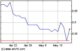
Intermap Technologies (TSX:IMP)
Historical Stock Chart
From Dec 2024 to Jan 2025

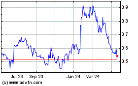
Intermap Technologies (TSX:IMP)
Historical Stock Chart
From Jan 2024 to Jan 2025
