Indigo Exploration Inc. Provides Update on Kodyel Gold Prospect, Burkina Faso
22 May 2013 - 6:20AM
Marketwired Canada
Indigo Exploration Inc. (TSX VENTURE:IXI)(FRANKFURT:INE) announces that the
World Court has handed down its decision on the position of the Burkina Faso -
Niger border, which is in Burkina Faso's favour in the vicinity of the Kodyel
permit. In addition, the Company announces additional positive soil and rock
sampling results on its Kodyel grid.


The Company wishes to provide a link to the World Court's decision on the
previously disputed portion of the Burkina Faso - Niger border position;
http://www.icj-cij.org/docket/files/149/17306.pdf. Of particular interest, are
maps 1 and 4 on their pages 28 and 51, which show the border position before and
now through the court decision. The governments of Burkina Faso and Niger have
stated that they would both accept the World Court's decision in the matter. A
BBC news article summarizes the decision
(http://www.bbc.co.uk/news/world-africa-22165499). Kodyel Permit lies near the
portion of the border southeast of River Sirba. According to Company's analysis
of the maps, the new position of the border near Kodyel is approximately 6 km
further northeast from where it was on the 1960 IGN map, in Burkina Faso's
favour.


The Company also has received new soil and rock sample results from the Kodyel
grid. The 48 square kilometres soil grid on its flagship Kodyel permit was
conducted over the 15 kilometre stretch of favourable geology and artisanal
workings between the Tangounga pit and the CFA Zone drilled by Semafo in 1997.
Results from 65% of the grid were reported August 15, 2012 (NR12-06). Results
from the remaining 35% of the grid are now available and improve on the
anomalies. Collectively, the 2012 and 2013 soil results demonstrate multiple
gold soil anomalies. The most significant anomaly measures 5.5 kilometres long
by 600 metres wide with values generally greater than 50 ppb Au, corresponding
to an interpreted regional right lateral fault. The east end of this soil
anomaly lies 2.5 kilometres short of the Tangounga pit. To date, no soil
sampling has been done in this 2.5 kilometre gap, nor in the Tangouonga pit
area. Another significant gold anomaly is 1.5 kilometres long by 1 kilometre
wide and corresponds with an interpreted structural dilation zone related to the
regional right lateral fault. The structural interpretation and soil anomalies
will be posted on the Company website. During the soil sampling program,
geologists also mapped numerous artisanal workings and zones of substantial
quartz float strung along a 15 kilometre stretch overlying the interpreted
regional right lateral fault. The Company has received some of those rock
samples. 23 samples of 226 rock samples returned greater than 0.5 g/t Au to a
high of 84 g/t Au. Additional rock sampling is in progress.


The gold soil anomalies to date constitute strong drill targets and confirm the
sizeable potential of its flagship project.


On Behalf of the Board of Directors,

Paul Cowley, Interim CEO

FOR FURTHER INFORMATION PLEASE CONTACT:
Indigo Exploration Inc.
Paul Cowley
(604) 340-7711


Indigo Exploration Inc.
Keir Reynolds
(778) 998-9242
www.indigoexploration.com
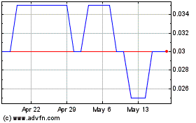
Indigo Explorations (TSXV:IXI)
Historical Stock Chart
From Feb 2025 to Mar 2025

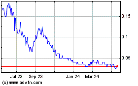
Indigo Explorations (TSXV:IXI)
Historical Stock Chart
From Mar 2024 to Mar 2025

Real-Time news about Indigo Explorations Inc (TSX Venture Exchange): 0 recent articles
More Indigo Exploration Inc. News Articles